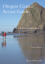
Oregon Coastal Access Guide
Kenn Oberrecht
Oregon Sea Grant
Oregon is renowned not only for the natural beauty of its coastline but also for its enlightened tradition of publicly owned and protected beaches. The revised and updated Oregon Coastal Access Guide is essential for anyone exploring the nearly four hundred miles of coastline that lie between the Columbia River and the California border.
Now revised and updated, the Access Guide offers a north-to-south tour of Oregon's Pacific edge, with extensive mile-by-mile coverage of scenic U.S. Highway 101. It provides a convenient and reliable reference on where to go, how to get there, and what to expect, including
- Thorough descriptions of beaches, parks, forests, campgrounds, boat ramps, picnic areas, and hiking and equestrian trails
- Details on and directions to natural areas, from estuaries and lakes to dunes and headlands
- Up-to-date information on outdoor recreation, including angling, crabbing, clamming, boating, whale watching, golfing, photography, surfing, and cycling
- Features on a range of topics, including history, weather, tides, marine and coastal wildlife, cultural attractions, and historic coastal bridges
- Listings of resources to help travelers plan and enjoy their trips
Kenn Oberrecht's detailed knowledge of the Oregon coast--he has driven thousands of miles on coastal roads and hiked hundreds of miles on beaches and trails--informs every page of this indispensable guide.
About the author
Kenn Oberrecht has lived on the southern Oregon coast since 1975. He is a noted photographer and a widely published author of books and articles on travel, outdoor recreation, nature, and the environment.
Read more about this author
Map of the Oregon Coast
Traveling the Oregon Coast U.S.
101, mile 0 to mile 363.1
The Coastal Counties
Oregon's Public Beaches
Oregon Pacific Coast Passport
The Oregon Coast Trail
The Oregon Coast Bike Route
Where to Stay
Camping Along the Oregon Coast
Lodging Along the Oregon Coast
Oregon's Historical Lighthouses
Map of Lighthouses on the Oregon Coast
Life in the Coastal Zone
Climate and Weather in the Coastal Zone
Dressing for Coastal Weather
Planning a Coast Trip
Maps of the Coast
Getting to the Oregon Coast
Mileposts
Map of Bridges on the Oregon Coast
Pacific Standard, Daylight Saving, and Oregon Coast Time
Shipwrecks Along the Oregon Coast
Hazards of Coastal Travel and Recreation
Personal Flotation Devices
Coastal Shoreline Hazards
Killer Logs
Swimming and Wading
Tsunamis
Sneaker Waves
Have a Safe Trip
Information
Feature: Best Festivals, Fairs, and Events on the Oregon Coast
History of the Oregon Coast
Early Inhabitants of the Oregon Coast
Early Explorers Along the Oregon Coast
Fur Traders
Pioneers and Settlers
Settlement of the Oregon Coast
Map of Clatsop County Coast
The Clatsop County Coast
U.S. 101, mile 37.1 to mile 102.7
Columbia River
Astoria
Warrenton
![]() Fort Stevens State Historical Site and Military Museum
Fort Stevens State Historical Site and Military Museum
![]() Fort Stevens State Park
Fort Stevens State Park
![]() Fort Clatsop National Memorial
Fort Clatsop National Memorial
Gearhart
Seaside
![]() Seaside Visitors Bureau
Seaside Visitors Bureau
![]() Ecola State Park
Ecola State Park
Cannon Beach
Side Trip: U.S. Route 30, Astoria
![]() Astoria Column
Astoria Column
![]() Columbia River Maritime Museum
Columbia River Maritime Museum
Information
Feature: Know the Tides
Map of Tillamook County Coast
The Tillamook County Coast
U.S. 101, 37.1 to mile 102.7
![]() Oswald West State Park
Oswald West State Park
Manzanita
Nehalem
Wheeler
Rockaway Beach
Garibaldi
Bay City
![]() Tillamook County Creamery Association
Tillamook County Creamery Association
Tillamook
![]() Tillamook Pioneer Museum
Tillamook Pioneer Museum
![]() Tillamook Air Museum
Tillamook Air Museum
Hebo
Cloverdale
Neskowin
Side Trip: ![]() Three Capes Scenic Loop
Three Capes Scenic Loop
![]() Cape Meares State Scenic Viewpoint
Cape Meares State Scenic Viewpoint
Oceanside
Netarts
![]() Cape Lookout State Park
Cape Lookout State Park
![]() Anderson's Viewpoint
Anderson's Viewpoint
Pacific City
![]() Cape Kiwanda County Park
Cape Kiwanda County Park
![]() Cape Kiwanda State Natural Area
Cape Kiwanda State Natural Area
Feature: The Dory Fleet
Information
Feature: Crabbing on the Oregon Coast
Map of Lincoln County Coast
The Lincoln County Coast
U.S. 101, mile 102.7 to mile 167.6
Lincoln City
Feature: Oregon's Estuaries--The Ocean's Nursery
Table: Filmed on the Oregon Coast
Gleneden Beach
Depoe Bay
![]() Depoe Bay Promenade
Depoe Bay Promenade
![]() Devil's Punch Bowl State Natural Area
Devil's Punch Bowl State Natural Area
Newport
![]() Yaquina Head Outstanding Natural Area
Yaquina Head Outstanding Natural Area
![]() Yaquina Bay State Recreation Area
Yaquina Bay State Recreation Area
![]() Yaquina Bay Lighthouse
Yaquina Bay Lighthouse
![]() Oregon State University Hatfield Marine Science Center
Oregon State University Hatfield Marine Science Center
![]() Oregon Coast Aquarium
Oregon Coast Aquarium
Seal Rock
Waldport
![]() Alsea Bay Historic Interpretive Center
Alsea Bay Historic Interpretive Center
![]() Yachats
Yachats
![]() Cape Perpetua Scenic Area
Cape Perpetua Scenic Area
Side Trip: Three Rocks Road
Information
Feature: Marine Birds, Seals, and Sea Lions
Map of Lane County Coast
The Lane County Coast U.S. 101 mile 167.6 to mile 198.6
![]() Heceta Head State Park and Devils Elbow
Heceta Head State Park and Devils Elbow
![]() Heceta Head Lighthouse State Scenic Viewpoint
Heceta Head Lighthouse State Scenic Viewpoint
Florence
![]() Old Town Florence
Old Town Florence
Table: Oregon Coast Golf Courses at a Glance
![]() Oregon Dunes National Recreation Area
Oregon Dunes National Recreation Area
![]() Jesse M. Honeyman Memorial State Park
Jesse M. Honeyman Memorial State Park
Siltcoos Recreation Area
Information
Feature: Digging Clams on the Oregon Coast
Feature: Red Tides and Paralytic Shellfish Poisoning
Map of Dougals County Coast
The Dougals County Coast
U.S. 101 mile 198.6 to mile 220.6
Gardiner
Reedsport
![]() Umpqua Discovery Center
Umpqua Discovery Center
![]() Dean Creek Elk Viewing Area
Dean Creek Elk Viewing Area
Winchester Bay
![]() Salmon Harbor Recreation Area
Salmon Harbor Recreation Area
![]() Umpqua Lighthouse State Park
Umpqua Lighthouse State Park
Umpqua River Light Station
Information
Feature: Watching Whales on the Oregon Coast
Map of Coos County Coast
The Coos County Coast
U.S. 101 mile 220.6 to mile 285.8
Lakeside
![]() Tenmile Lakes
Tenmile Lakes
![]() Coos Bay
Coos Bay
North Bend
Coos Bay
![]() Bullards Beach State Park
Bullards Beach State Park
![]() Coquille River Lighthouse
Coquille River Lighthouse
Bandon
![]() Old Town Bandon
Old Town Bandon
![]() New River Area of Critical Environmental Concern
New River Area of Critical Environmental Concern
Side Trip: ![]() Trans-Pacific Parkway and Oregon Dunes
Trans-Pacific Parkway and Oregon Dunes
Side Trip: ![]() State Route 240, Cape Arago Highway
State Route 240, Cape Arago Highway
![]() Charleston
Charleston
![]() South Slough National Estuarine Research Reserve
South Slough National Estuarine Research Reserve
![]() Sunset Bay State Park
Sunset Bay State Park
![]() Cape Arago Lighthouse Viewpoint
Cape Arago Lighthouse Viewpoint
![]() Shore Acres State Park
Shore Acres State Park
![]() Simpson Reef and Shell Island Overlook
Simpson Reef and Shell Island Overlook
![]() Cape Arago State Park
Cape Arago State Park
Side Trip: ![]() County Road 29, Beach Loop Road
County Road 29, Beach Loop Road
Information
Feature: Crimson Berries of the Bog
Map of Curry County Coast
The Curry County Coast
U.S. 101 mile 285.8 to mile 363.1
Langlois
![]() Cape Blanco
Cape Blanco
![]() Cape Blanco State Park
Cape Blanco State Park
![]() Cape Blanco Lighthouse
Cape Blanco Lighthouse
Port Orford
![]() Port Orford Heads State Park
Port Orford Heads State Park
Ophir
Gold Beach
![]() Jerry's River Museum
Jerry's River Museum
![]() Cape Sebastian State Scenic Corridor
Cape Sebastian State Scenic Corridor
![]() Samuel H. Boardman State Scenic Corridor
Samuel H. Boardman State Scenic Corridor
Brookings
![]() Azalea Park
Azalea Park
Information
Feature: Stranded Marine Mammals
Bibliography
Index
"A thorough and imminently useful guide… In fact, this book is closer to the ideal than any other on the subject." --The Statesman Journal