Like the smell of rain on wet pavement
or the taste of a good microbrew, Douglas fir forests seem patently Oregonian. Trees
feature prominently in our landscapes, in the Capitol building, and even on our
license plates. Today, many lobbyists and citizens push for the conservation of
old-growth forests that preserve such an iconic and integral aspect of our
state. But forest conservation hasn’t always been at the forefront of
Oregonians’ concerns.
Science historian Emily K. Brock joins
us today to share a bit of conservation history within the Beaver state. Her
new book, Money Trees: The Douglas Fir
and American Forestry, 1900 – 1944, explores patterns of forest management
and the complicated correlation between humans and nature.
------------------
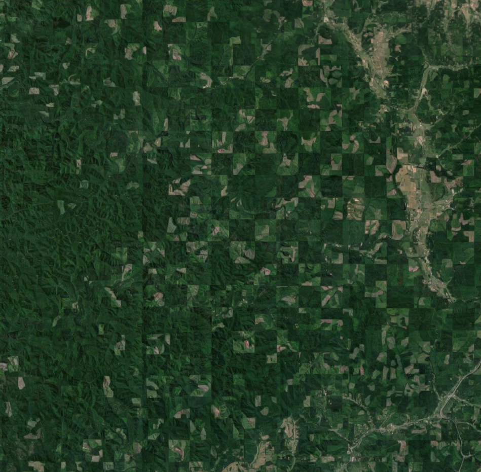
If you look at
satellite images of southwestern Oregon today, you can make out faint traces of
a gigantic checkerboard design etched into the forest. The checkerboard is a
still-visible remnant of management decisions made in the 1860s. The
persistence of the checkerboard, and its relation to conservation, is a
reminder that when you hike through an American forest, you are always walking
through a landscape created by past decisions.
Foresters, loggers,
landowners, politicians, regional planners, and many others have made decisions
or taken actions that impacted forests. Whether to log, plant, or preserve,
those forest management decisions will carry over to the present day. Because
forests take so long to grow, decisions they made can resonate in the forest
for decades, even centuries, into the future.
We can find an
example of the value of forest history in the famously contentious case of the
Northern Spotted Owl. Knowing the historical background of the case gives a new
insight into why the owl became so threatened, and why conserving it became not
just ecologically difficult, but economically and politically difficult too.
This story begins
in 1866, when the federal government granted public domain lands to a company called
the Oregon and California Railroad to build a rail link between Portland and
California. These lands, like most railroad grant lands of the time, were
divided into a checkerboard in which the railroad received every other square. In
the case of the O&C, their checkerboard squares were mostly thickly covered
with intact Douglas fir forest. Generally, as a railroad grew, it would sell
off such grantland to raise revenue. However, due to various legal and
financial difficulties, little of it was ever put up for sale. The forests
eventually came under the control of the General Land Office, but remained
mostly unlogged and undeveloped.
It was not until the
late 1930s that the checkerboard survey would really have an effect on these
forests. With the aim of showing how methodologically sophisticated his
department was, the Secretary of the Interior Harold Ickes spearheaded an
effort to enact advanced system of forest management on the lands through the
1937 O&C Act. The checkerboard soon became an experiment in sustained-yield
forest management and rural planning.
Those property
lines caused more trouble than anyone expected when the checkerboard was first
drawn. While the public squares of the O&C lands are now controlled by the
Bureau of Land Management, the successor agency to the General Land Office, the
private squares have met various fates. Some are still managed for timber, some
have been developed for agriculture or settlement, and some were incorporated
into the BLM holdings through land swaps.
The O&C Act contained
stipulations that county governments benefited more from O&C logging than
from logging activity taking place on, for example, National Forest land.
Instead of the 25% of gross receipts received from national forest logging
taking place within a county’s borders, the county would receive 50% from
O&C logging. Many of the eighteen “O&C Counties,” with O&C
checkerboard land in them came to rely heavily on that revenue to finance
county infrastructure, buildings, and government services. Further, many
residents of the counties found steady, well-paid employment in the lumber
industry.
Compounding the issue,
the Bureau of Land Management habitually authorized more logging, and regulated
it less, than did the U.S. Forest Service. As Forest Service regulation became
more stringent in the latter half of the twentieth century, the logging on the
O&C lands became more lucrative for logging companies to pursue. The rate
of logging on O&C lands authorized by the B.L.M. was often well above what
sustained yield calculations would have specified. Eventually the overcut would
have forced the O&C Counties to a reckoning, but before that day arrived, a
little gray owl changed the rules of the game.
The Northern
spotted owl is a small, shy owl which lives in Pacific coast forests, and which
depends on natural Douglas fir or coast redwood forests for nesting, foraging,
and roosting. Its population levels had dipped low enough by 1990 to be
federally designated a threatened species.
In the years
following this designation, scientists predicted that the owl would go extinct
if any more of its habitat was destroyed. The problem wasn’t just the acreage
of habitat, but the fact that the owl didn’t like to nest close to buildings,
roads, or any other sign of human development. While over seven million acres
of federally-owned old-growth Douglas fir forest still remained in the Pacific
Northwest, much of that forest was in the form of the O&C checkerboards and
other heavily-fragmented landscapes. These forests were already so fractured by
human use that much of their acreage was not suitable for the owls.
To save the owl
from extinction, the federal government deemed further habitat fracturing had
to be avoided. This meant a slowdown of logging in national forests, and an
almost complete cessation of logging on the O&C lands. The O&C checkerboard
design, which had initially been devised to promote economic growth and
regional development, was now the very thing that necessitated a logging
shutdown. Because local governments in the O&C Counties had grown dependent
on revenue generated by B.L.M. lumbering, the shutdown affected not just those
employed by the lumber industry but all citizens of the counties. Local
anti-environmentalist sentiment rose as the full ramifications of the 1994
Northwest Forest Plan unfolded. The changes do seem to have slowed the decline
of owl populations, although the species now faces new threats to its
existence.
The residents of
the O&C Counties had been pawns in the struggles between private companies
and federal government since the 1860s, when their forests had first been
gridded with the surveyors’ checkerboard. The federal government reversed the
promises of the O&C Act, grounded in 1930s ideals of sustained-yield forest
management, in order to enforce the Endangered Species Act, grounded in 1970s
ideals of conservation biology. Victims of historical shifts in government
goals, environmental values, and scientific agendas, the O&C Counties have
still not fully righted themselves from the economic tumult of the twentieth
century.
As the example of
the spotted owl shows, to understand people’s relationships to forests, it
helps to know not just what is going on in them today, but also their history. 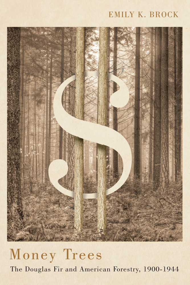
My new book, Money Trees: The Douglas Fir and American
Forestry, 1900-1944, is about management of Douglas fir forests, but also
about the ways the challenges of managing the Douglas fir forests of the
Pacific Northwest influenced the profession of American forestry. The history
of the O&C Lands is one part of this bigger story of forest management in
this region. Knowing forest history can deepen our knowledge of these
landscapes, and aid our understanding of the complex relationships between
humans and forests.
------------------
Emily K. Brock is a historian whose
research focuses on American natural resource management and the
interconnections between industry, science, and conservation. After receiving
her Ph.D. from Princeton University, Brock went on to teach at several academic
institutions, including Stanford University. She currently serves as a research
scholar at the Max Planck Institute for the History of Science in Berlin,
Germany. Money Trees is her first
book.
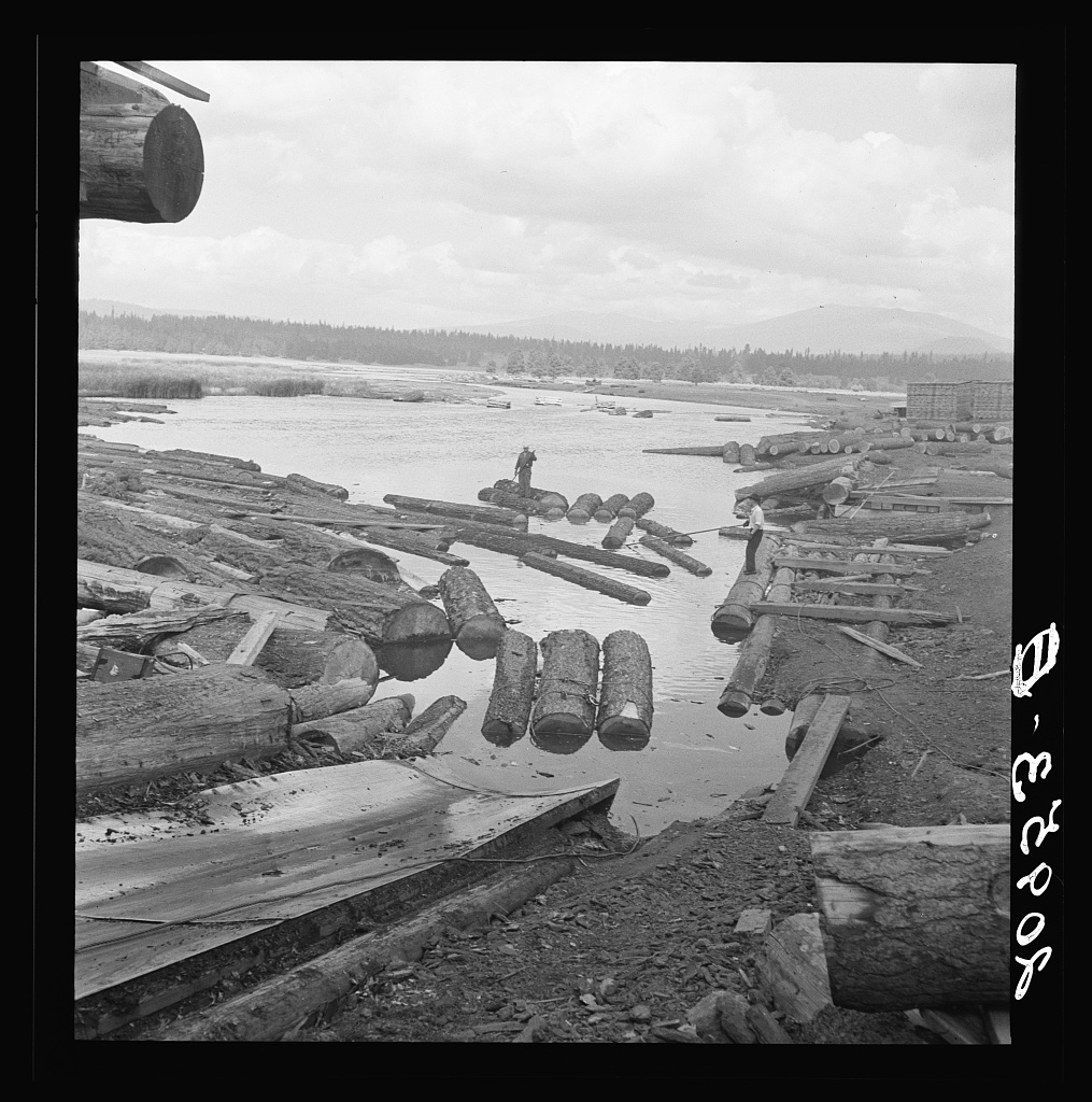
Image Captions & Credits
Checkerboard Landscape: The checkerboard patterning, a legacy of the O&C
Railroad land grant, is still apparent in this contemporary Google Earth
satellite image of the forestland directly west of Cottage Grove, OR.
Klamath Log Chute: Log rafts on the edge of the Klamath River in 1939, near
the small town of Keno, OR. Photo by Dorothea Lange. Library of
Congress reference LC-USF34-020953.